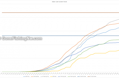
Wells dam is the last hurdle the sockeye face before reaching the Okanogan. The fish will usually hold for a little while below the dam before tackling the fish ladder. This gives us a chance to target them.
To learn tips and tricks for catching sockeye check out the sockeye page.
The launch is out of the current and has a nice concrete slab. There is lots of gravel shore on either side to beach the boat while you clean fish or deal with the car.
Due to the proximity of the dam it is greatly and immediately impacted by any changes in water flow. As such expect the launch to potentially change between uses. Also be watchful when your boat is on the beach – you don’t want it to get stuck or float off.
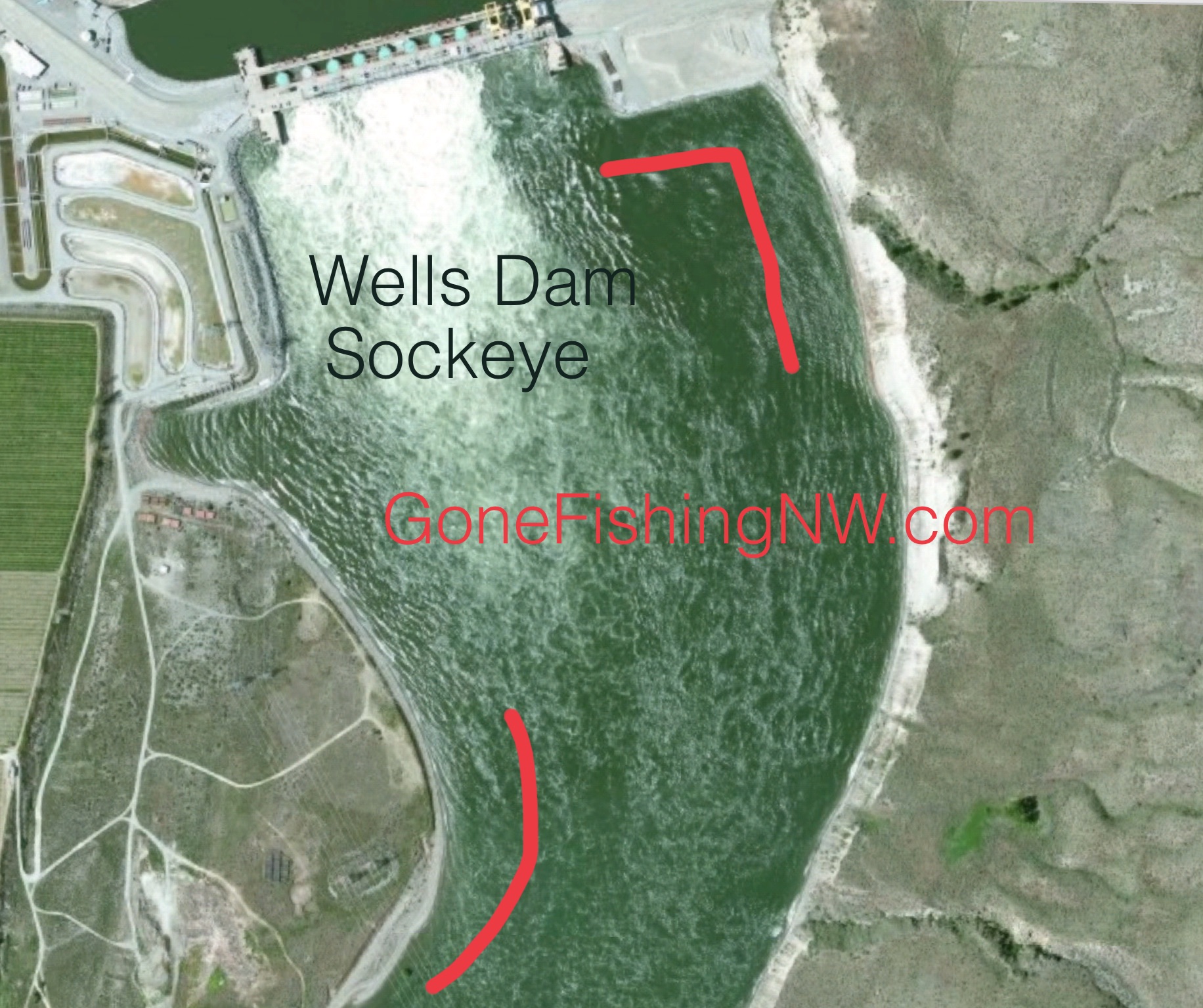
The primary sockeye area is the big eddy on the other side of the river. Exercise judgement crossing the river, as the flow is usually considerable.
The secondary area is on the launch side of the river, just downstream a little out of the central flow.
In both areas the depth can change rapidly so keep on eye on the finder until you have it mentally mapped out.

For information on sockeye rigs for Wells Dam please check this out.